Member-only story

Android is the fastest growing mobile operating system based on the Linux kernel, and having its own Java implementation from Google. It’s the brainchild of the search giant, which not only has released an open source platform, but also created the Open Handset Alliance, through which we have SDK at our disposal. Google has adapted its many services under the mobile platform, and Google Maps being among them. Just what we will be talking about today.
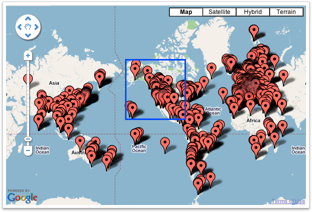
Location data plays a big role in building a great mobile app experience. Maps are immersible and users are increasingly demanding of a highly-responsive experience.Android Google Maps APIv2 is quite topical at the moment. I think it’s needless to talk about how to connect the service, get the keys and start to work — you can easily find such information on the Internet. So we’ll go straight to the point. When designing the project the task was to display the map markers, which are divided into several types (with help of Google Maps markers clustering). But, for example, nearby markers when zoomed out overlapped the way it all looked like one continuous blur. They were to be grouped — clustered — with regard to the type of each marker. Standard toolkit looked poorly for solving such problems. Of course, you could create your own class that inherits markers, and extending it at the same time. But why reinvent the wheel if a similar problem…
